Silva Expedition Baseplate Compass - Professional Grade Navigation
Silva Expedition Baseplate Compass - Professional Grade Navigation
SilvaCouldn't load pickup availability
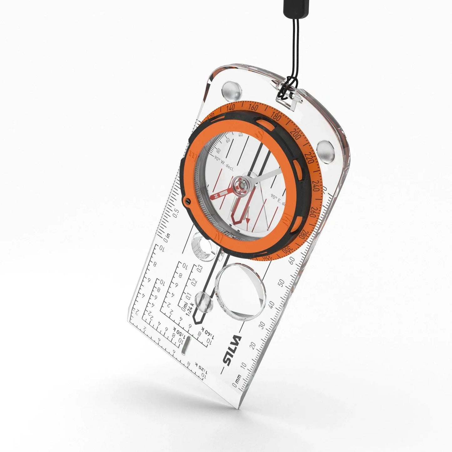
Whether you’re navigating the dense fog of the South Shore or plotting a course through the thick woods of the highlands, GPS is great until the batteries die or the signal drops. The Silva Expedition is the gold standard in analog reliability—an "expert-level" baseplate compass designed for those who take their navigation seriously. It’s not just a pointer; it’s a precision tool kit for your map. Featuring a built-in clinometer for measuring slopes, a magnifying lens for fine map detail, and a unique scale lanyard that lets you measure your route as easily as laying down a piece of string, it turns "finding your way" into a science. It is the ultimate insurance policy for your backcountry kit, ensuring you always have a clear path home, regardless of the terrain or the tech.
- Advanced Navigation Toolkit: Includes a slope card and a clinometer to help you judge terrain difficulty and measure slope angles—essential for both route planning and safety in steep areas.
- Scalable Distance Lanyard: The detachable lanyard is soft, bendable, and marked with 1:25 and 1:50 scales, allowing you to measure the actual curves of your trail directly on the map.
- Precision Map Work: Silicon rubber friction feet prevent the compass from sliding on your map, while the integrated magnifying lens helps you spot the smallest contour lines and landmarks.
- All-Hours Reliability: Features luminous markings that stay visible for up to 4 hours after light exposure, making night navigation or low-light woods travel much safer.
- Global Accuracy: Equipped with a permanent magnetic declination adjuster, so you can set it once for your local area and read true north directly from the dial without doing manual math.
Best For
- The Effort: Advanced hiking, search and rescue, orienteering, and professional field work.
- The Goal: Precise, fail-proof navigation that doesn't rely on satellites or batteries.
- The Conditions: Thick coastal fog, dense forests, and any adventure requiring high-detail map reading.
Technical Specifications
- Accuracy: 1°
- Scales: 1:25k, 1:40k, 1:50k, mm, inch, GPS scales
- Special Features: Clinometer, Slope Card, Scale Lanyard, Magnifying Lens
- Durability: Waterproof, Swedish steel needle with sapphire jewel bearing
- Dimensions: 12.7 x 6.0 x 1.3 cm
- Weight: 50 g